- Region
- Águilas
- Alhama de Murcia
- Jumilla
- Lorca
- Los Alcázares
- Mazarrón
- San Javier
-
ALL AREAS & TOWNS
- AREAS
- SOUTH WEST
- MAR MENOR
- MURCIA CITY & CENTRAL
- NORTH & NORTH WEST
- TOWNS
- Abanilla
- Abarán
- Aguilas
- Alamillo
- Alcantarilla
- Aledo
- Alhama de Murcia
- Archena
- Balsicas
- Blanca
- Bolnuevo
- Bullas
- Cañadas del Romero
- Cabo de Palos
- Calasparra
- Camping Bolnuevo
- Campo De Ricote
- Camposol
- Canada De La Lena
- Caravaca de la Cruz
- Cartagena
- Cehegin
- Ceuti
- Cieza
- Condado de Alhama
- Corvera
- Costa Cálida
- Cuevas De Almanzora
- Cuevas de Reyllo
- El Carmoli
- El Mojon
- El Molino (Puerto Lumbreras)
- El Pareton / Cantareros
- El Raso
- El Valle Golf Resort
- Fortuna
- Fuente Alamo
- Hacienda del Alamo Golf Resort
- Hacienda Riquelme Golf Resort
- Isla Plana
- Islas Menores & Mar de Cristal
- Jumilla
- La Azohia
- La Charca
- La Manga Club
- La Manga del Mar Menor
- La Pinilla
- La Puebla
- La Torre
- La Torre Golf Resort
- La Unión
- Las Palas
- Las Ramblas
- Las Ramblas Golf
- Las Torres de Cotillas
- Leiva
- Librilla
- Lo Pagan
- Lo Santiago
- Lorca
- Lorquí
- Los Alcázares
- Los Balcones
- Los Belones
- Los Canovas
- Los Nietos
- Los Perez (Tallante)
- Los Urrutias
- Los Ventorrillos
- Mar De Cristal
- Mar Menor
- Mar Menor Golf Resort
- Mazarrón
- Mazarrón Country Club
- Molina de Segura
- Moratalla
- Mula
- Murcia City
- Murcia Property
- Pareton
- Peraleja Golf Resort
- Perin
- Pilar de la Horadada
- Pinar de Campoverde
- Pinoso
- Playa Honda
- Playa Honda / Playa Paraíso
- Pliego
- Portmán
- Pozo Estrecho
- Puerto de Mazarrón
- Puerto Lumbreras
- Puntas De Calnegre
- Region of Murcia
- Ricote
- Roda Golf Resort
- Roldan
- Roldan and Lo Ferro
- San Javier
- San Pedro del Pinatar
- Santiago de la Ribera
- Sierra Espuña
- Sucina
- Tallante
- Terrazas de la Torre Golf Resort
- Torre Pacheco
- Totana
- What's On Weekly Bulletin
- Yecla


- EDITIONS:
 Spanish News Today
 Alicante Today
 Andalucia Today
A history of Mula
The strategic location and natural resources of Mula shape its rich history
Water resources and strategic importance have defined the history of Mula from prehistory to the modern day, its natural water sources and position as the gateway to the north-west ensuring it has an astonishing richness of archaeological sites as one of the legacies of a series of civilisations which took advantage of what it has to offer.
Prehistory
Prehistoric settlers sought water, food and shelter and the locations of the earliest settlements in the Region of Murcia were dictated by the availability of these precious resources.
Mula has a rich geographical diversity including natural plains, mountainous crags and outcrops and a natural river valley which offered ideal conditions for these early settlers, and around 100 early archaeological sites date back into prehistory. The River Mula basin, which lies between the Sierra Espuña, the Sierra de Ricote and the Sierra de Cambrón, boasts a rich heritage of remains, one of the earliest sites being the Cueva Antón, believed to date back to between 40,000 and 38,000 years ago. This places it at the end of the Middle Paleolithic period, and it lies on the shores of what is now the Pantano de la Cierva reservoir.
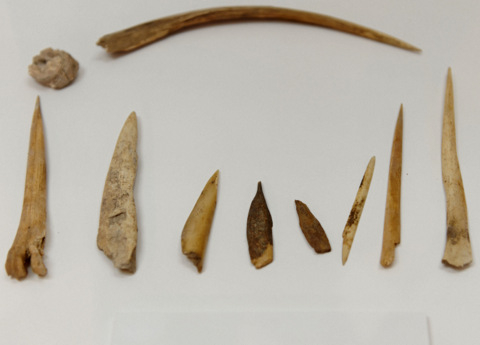 In 1995 excavations were carried out prior to the construction of the reservoir and the results revealed a great deal of material relating to hunting and flint-crafting activity, as well as evidence of fire within the cave. The site is now semi-submerged. The Cueva del Búho is another site showing evidence of prehistoric occupation, and has been dated at around 12000 BC, in the Magdalenian period of the Upper Paleolithic.
The Neolithic Era in Mula
This is the period when the transition began from hunter-gatherer subsidence to farming and settlements became more permanent as farmers began to work the land rather than rely on what count be hunted.
During this era the first permanent settlements were built, as populations began to increase and dwellings were constructed to obviate the need to find natural shelter, and the first remnants of clay pottery began to be manufactured.
Mula has a number of Neolithic settlements, including the Abrigo del Milano, Cejo Cortado and Hondo del Cajitán.
The Abrigo del Milano and Cejo Cortado contain prehistoric rock paintings and burials.
The Abrigo del Milano is located close to the boundary with Bullas, not far from the road which links to Zarzadilla de Totana on the right hand margin of the river Mula, in the Barranco de la Cueva. This site is of particular interest as the rock paintings date back to considerably earlier than the burials inside, which have been dated at around 3235 BC, at the end of the Neolithic as it passed into a new era, the eneolitic or Bronze Age. There are several different burials in this location, the most important being a group of 5 individuals, lying in a foetal position and all facing the same direction, but the site was also used 1300 years later, albeit for a single burial.
There are a number of paintings depicting human figures and hunting activity.
The Cejo Cortado is another important cave, situated in the pedanía of Yéchar, and was discovered in 1998. Although the paintings have deteriorated, the site is still an important location for what are known as naturalistic levantine rock paintings.
Another site is the Hondo del Cajitán, in which various ceramic objects have been found. This last settlement is unusual in that it is located on the plain rather than in a cave, one of the first transitions into more established settlements, and represents a period of transition about which very little is known. The ceramics found at this site can be seen in the Archaeological Museum of Murcia.
The Argaric culture in Mula
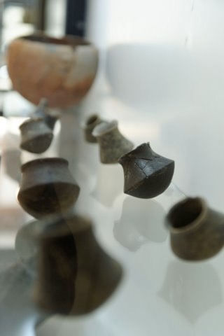 The Argaric culture was dominant in the south-east of Spain between 1800 and 1200 BC (although the latest excavations at La Bastida in Totana point to the culture being present from as long ago as 2200 BC), the major sites relating to it being located in Almería and Murcia and other remains discovered in the provinces of Alicante, Albacete, Jaén and Granada.
The first real definition of the Argarics as a culture came following the excavation of a site in the area of El Argar in Almeria, although the true origins of these people are the subject of much speculation.
Where they originally came from is not clear, although there have been several theories expressed that their technology and skills could have developed from contact with other Mediterranean civilisations.
The Argarics tended to choose sites with strategic advantages such as the natural protection of height and the ability to keep an eye on movement around them, although water sources were also of great importance, as were natural seams of minerals.
In the Mula area sites have been discovered at Cabezo de la Plata, Castillo de La Puebla, Cabezo Inés, Almoloya and Cabecico de los Tesoros.
The clear development of mankind into more established communities can clearly be seen in Argaric burials and the sites excavated. These communities had evolved into more substantial units, the members building tighter settlements with a clear walled defensive structure, and there is also often evidence of lookout posts. Dwellings ceased to be isolated round huts and formed into a more compact space, square housing units with indications of streets between them, stone and wood the principal building materials.
Settlements ranged from small groups of dwellings to quite substantial towns, the largest of which in the Region of Murcia is in Totana, at La Bastida.
One of the major advances being made by mankind in this era was the development of metallurgy, and the Argaric peoples had a good knowledge of mining and smelting techniques, as can be seen from the articles found in Argaric excavations, as well as great skill in the production of ceramics. The development of metallurgical skills enabled Man to totally change hsi way of life as metal tools replaced flints, agricultural tools made it possible to increase agricultural production (removing the need for manual labour), and at the same time led to fewer individuals producing food for the community so that others could specialise in producing trade goods.
Most of the finds recovered from this period have survived in the burials excavated, many of which were beneath the floor in the home of the deceased or within the settlements.
The deceased were habitually buried inside a kist, a stone container, or a large ceramic urn. Grave goods were frequently found with the bodies, and although burials often relate to a single individual there are examples with more than one individual within a single grave. Occasionally grave goods have been discovered without a body, perhaps indicating that the deceased had died away from the settlement and the body had not been recovered: it varies from site to site.
By this period there is evidence of specialisation, with certain individuals clearly showing status or a single trade, and the manner of burials also indicates ritual belief, a grounding for the more definable religious beliefs which would develop later.
The quality of the ceramics and the development of metal jewellery as the metallurgical skills increased indicate the first signs of individual status and exposure to external cultures.
In addition, the excavations also reveal a social structure, in the case of the Argarics with a top level accounting for around 10% of the population, a "working class" which appear to encompass artesans and skilled craftsmen accounting for around 50% and a "servant" or "slave" class, clearly those undertaking the manual labour, representing the remaining 40%.
The Iberians and El Cigarralejo
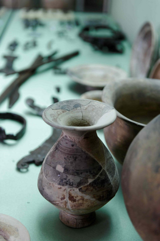 The Iberian culture was dominant in Spain from the 5th to the 1st century BC, and Mula is the location of the most important Iberian excavation site in the Region of Murcia, El Cigarralejo. Located on a hill about 2 km outside of Mula between two rocky outcrops, above the right bank of the River Mula, it could not be reached from the north or east sides, giving it a natural defence system.
The site at El Cigarralejo consists of three areas, the town, the burial ground or necropolis and the sanctuary (or holy place), and was discovered in the 1940´s.
Excavation was undertaken by archaeologist Emeterio Cuadrado, who excavated a total of 547 burials in the necropolis and collected a vast array of grave goods which give valuable clues regarding the lifestyle of those who were buried here, as well as their economy, agricultural production, trading activity and social structure. Just a small percentage of the items recovered are on display in the Museo El Cigarralejo, dedicated exclusively to this site, which is well worth a visit.
The Iberians themselves were a cosmopolitan people who traded with the Phoenicians and Greeks along the Mediterranean coastline and possessed high levels of skill in metallurgy, ceramics and textiles. Although their economy was based on agriculture, they were also merchant traders and warriors and their culture only disappeared as a definable culture following the invasion of southern Spain by the Romans in 209BC. The Romans were masters at exploiting the natural resources of the areas they occupied but also believed in "romanising" their territories, and the Iberians were slowly subsumed into the fabric of Roman Spain until they ceased to exist as an independent culture in the 1st century BC.
Romanization in Mula
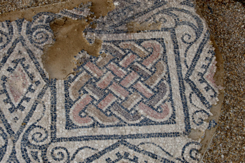 The Roman General Publius Cornelius Scipio completed the conquest of the south-east of the Spanish peninsula when he took Qart-hadast (now Cartagena) in 209 BC. With this conquest the peninsula came under the rule of Rome, and the process now known as Romanization began.
The Sierra Minera of Cartagena and La Unión was rich in minerals, including silver and lead, but other areas of what is now the Region of Murcia provided important resources. The whole area produced esparto grass, a valuable product used for making rope in a pre-nylon era and for many other utility uses, as well as marble, the "garum" fish sauces which were made along the coastline in Mazarrón and Águilas, and wine and olive oil produced in the warm Mediterranean climate for export and consumption in the City of Carthago Nova (now Cartagena).
The interior of the region was gradually occupied by agricultural "villas" with activity on a small to medium scale, enabling families and their slaves to be self-sufficient and sell any surplus production.
Various villas are known to have existed in the area of Mula, for example those of La Alquibla, Las Contiendas, Cabezo de la Tronera, Caputa, Cementerio Viejo and Cajitán, but the most extensive excavations have been carried out at Villaricos, a substantial agricultural villa dating from the first half of the first century AD. There is evidence that it continued to be occupied until the 5th century.
Its thermal baths are still preserved in good condition, as are the rooms relating to olive production, the principal activity of this villa.
As well as their villas, the Romans left behind important examples of their civil engineering, one example being the dam and channels at El Ardal, which fed into the thermal baths found at Fuente Caputa.
Cerro de La Almagra, Mula
Mula was also the location of a substantial Roman settlement on the Cerro de la Almagra, about 6 kilometres east of modern day Mula, on the left bank of the River Mula. This same location had previously been occupied by the Argarics and Iberians, strategically placed overlooking the valley below, and protecting the natural route through to the north and north-west.
The town had major fortifications with a substantial protective wall, and would have contained important civic buildings as well as a sizeable population.
Although some excavations have been carried out on the site, a large amount remains undocumented and a lot of damage has been caused by clandestine excavations and the removal of most of the building stone throughout the centuries for use in other locations: some has even turned up in the structure of the church in the village of Baños de Mula.
The settlement itself was almost certainly the original location of Mula and was mentioned in the Pact of Tudmir when the peninsula was invaded by the Moors in 713, although it is possible that it was destroyed not long afterwards as archaeologists discovered a 14cm layer of ash during their excavations, indicating that La Almagra had been destroyed by fire.
The ceramics recovered were of fine quality, indicating wealth, and there is also evidence of Christian activity, although there is still a significant amount of excavation to be undertaken here in the future.
Mula and the Moors
 As the Roman Empire crumbled and disintegrated, barbarian tribes moved into Spain from the germanic countries of central Europe. There is very little documented evidence of when they arrived in Mula, or of any activity in the area, but they certainly had a strong presence in nearby Cehegín, the walled settlement of Begastri (the Visigoth capital and seat of the Christian bishopric during the 6th century). In the 6th century the Byzantines temporarily occupied Cartagena, although they were once again expelled by the Visigoths, who razed Cartagena and strengthened fortifications at Begastri.
In 713 AD, Moorish troops led by Abd al-Aziz invaded the southern peninsula and swept across lower Spain. Rather than fight, the Visigoth overlord of the Levante area, Theudimer (or Tudmir) made an agreement, known by historians as the Pact of Tudmir, to pay taxes to the invaders and abide by their administrative system in return for the sovereignty and judicial status of himself as Governor, a position which he maintained for his lifetime, and that of his son as successor. 7 settlements are specifically mentioned in this document, one of them Mula (or at this point, Mula in the Cerro de la Almagra.)
Although there is little in the way of documentary evidence relating to the dates of any construction in Mula, the Moors opted to build their own new settlement, and constructed Mula in its present position. The old location of La Almagra was either abandoned or burnt during one of the internal conflicts which occurred following the death of Tudmir and his son.
The way the town grew was determined by the lay of the land, with the typical network of narrow, steep, labyrinthine streets, leaving little in the way of open space. There were two mosques, one on the site of the church of Santo Domingo and the other where the church of Nuestra Señora del Carmen now stands. Water was supplied by means of a system of wells and tanks, with stream water being channelled into them. The largest piece of Moorish civil engineering was the main water channel from the Fuente de Mula. A fortified wall protected the inner city, part of which can still be seen today.
A fortification was built on the outskirts of the town, overlooking the rivers and main communications route, the Castle of Alcalá. Moorish castles of this nature are generally a base for a small number of soldiers and were designed to provide shelter for the local villagers in times of danger. There was certainly a Moorish population at the foot of the castle in what is now the village of Puebla de Mula, but there is no documentary record of population levels at this point, but there was certainly danger, as the Christian forces of Aragón and Castile from the North of Spain pushed downwards in an attempt to evict the Moors from Spain: the Reconquista.
The Reconquista and Mediaeval Mula
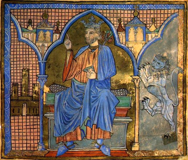 It took 200 years for the forces of Castile y León and Aragón to reclaim much of southern Spain, forcing the remaining Moors into the Kingdom of Granada. Spain was still a series of kingdoms at this point in history, and in 1243 a treaty called the pact of Alcáraz was signed, Ibn-Hud surrendering what is now the Region of Murcia to Fernando III of Castile and the forces of his son, Prince Alfonso (later King Alfonso X "El Sabio").
However, the towns of Lorca, Mula, Aledo and Cartagena refused to accept the terms of the surrender and had to be taken by force. In 1244 Prince Alfonso besieged Mula, which eventually surrendered when hunger got the better of the townspeople. The prince then left for Toledo, leaving a guard consisting of 80 knights. Many of these knights bore names which are still typical of Mula today, such as Saavedra, Luna, Párraga, Melgarejo, Llamas, Camacho, Campos, Valcárcel, Blaya, Molina, Guillén, Aparicio, Cueto, Portillo, Coy, Pelayo, Hita and Carreño. The remaining Moors soon had their land confiscated, and most of them were expelled and re-housed in La Puebla de Mula, at the foot of the Castle of Alcáraz, where the Christians built two watchtowers to guard over the Mula road and oversee the population.
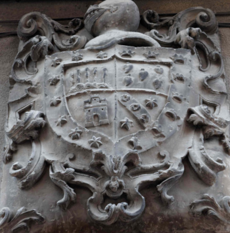
King Fernando III awarded Mula the status of royal borough in 1245, giving it the right to have its own council, seal and coat of arms. It also meant that Mula was exempt from paying the “portazgo”, a tax levied on merchandise transported from one kingdom to another. The local council consisted of two “alcaldes” (mayors) and nine other members, and the judicial system brought about an organized way of life despite the location of the town in frontier territory, close to the border with Granada.
Following the death of Ferdinand, his son Alfonso took the throne, becoming Alfonso X of Castile, and throughout his reign the settlements of Bullas, Pliego and Campos came under the jurisdiction of Mula. However, following his death there was a bitter war of succession, during which the nobility of Castile and Aragón supported their respective candidates and during the next 100 years the balance of power see-sawed between the 2 kingdoms.
The Middle Ages in Mula ended with an event which would cause continuous subsequent conflicts: in 1430, Juan II placed Mula in the hands of Alonso Yáñez Fajardo in recognition of his service in the struggle against Aragón, and the town gave up its status of royal borough in order to form part of the properties belonging to the future Marqueses de los Veléz.
The Marqueses de los Veléz in Mula
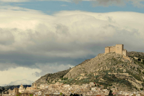 The Reconquista finally ended and the Kingdoms of Castile and Aragón were united by the marriage of Isabella and Ferdinand, the Catholic Monarchs, who combined their forces and succeeded in taking Granada in 1492.
The Moors were expelled from Granada and the zealous Catholic monarchs issued an order that any Moors who failed to convert to Christianity should be expelled from the country.
The population of Murcia increased as immigrants from other areas arrived looking for land to cultivate, and almost a hundred new families moved into Mula. As a result the city grew, extending downhill towards the valley, and establishing new city walls.
In the 16th century the growth of the city was even more significant. The main square appeared and became the centre of the town’s social life, and in it were built the clock tower, the prison, the Town Hall and the municipal grain depositary, as well as the Castillo de los Veléz.
However, this time was marred by constant conflict between the Marqueses de los Veléz and the townspeople, other powerful and wealthy families resentful of the power wielded by a largely absent Marquis who did little for the town other than demand taxes and interfere in local politics by the appointments made to his own supporters on the local council.
Furthermore, in the following century the local economy suffered a number of setbacks including floods, drought and plague. In 1648 a major outbreak of bubonic plague killed more than half of the population, creating shortages of skilled labourers and craftsmen and causing further famine as there were too few townspeople and farmers left to grow the necessary crops to sustain not only those who remained in the local town, but also in the city of Murcia, which had also been decimated by the outbreak. It was against this backdrop that the legend of the Niño de Mula emerged.
It took nearly a century for the town to recover from this disaster and for the population to return to former levels.
By the 18th century, the wealthier families had begun to build substantial properties for themselves as the regional economy boomed and the landowners became wealthier. Many of the impressive homes and churches in the town date from this period, including the Casa Pintada, which can be visited and is an impressive example of an urban baroque palace.
The 19th Century in Mula
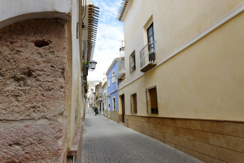 By the start of the 19th century the local economy was again struggling as a series of poor harvests, droughts and famines exacerbated the outbreaks of cholera and yellow fever which plagued the town.
In 1808, Spain was faced with the prospect of an unelected French monarch as both Carlos IV and his son, Ferdinand VII, a virtual prisoner in France, were forced to renounce their natural claims to the Spanish throne in favour of Napolean Bonaparte, who in turn, passed the throne onto his brother, Joseph.
However, although the elite in Madrid accepted this decision the Spanish people rebelled, the result being the Peninsular War, or War of Independence. An interim Spanish government was formed, with representatives from each province of Spain meeting first in Aranjuez and then in Sevilla before finally being pushed by Napoleon's forces into Cádiz.
The British, engaged in their own fight against Napoleon and his plans for European supremacy, supported the Spanish rebels, protecting the representatives until the "Cortes" could convene. By 1810 basic principles were being agreed, which accepted the legitimacy of Ferdinand as King of Spain although reducing his powers, but also took steps towards creating a more efficient civil service, reforming the tax system, replacing feudal privileges, recognition of an owner's right to use his property as he deemed appropriate and a reduction in the absolute power of the church, the crown and the nobility.
The first Constitution was prepared against a backdrop of continued French attack and promulgated on 19th March 1812 in Cádiz, nicknamed "La Pepa" by the Spanish as it falls on Saint Joseph's Day.
However, when Ferdinand returned to Spain and to power in 1814, his first act as monarch was to abolish the Constitution, and much of the property which had reverted to the state was then sold off at bargain prices, the rich thus becoming even richer by the process.
The Peninsular War left a considerable legacy in the Region of Murcia, French troops burning many churches on their passage through the region, as occurred in Mula in October 1812. More than 300 men from Mula left to take part in the War of Independence, but few returned.
The 20th Century in Mula
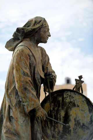 Two important improvements came to Mula at the start of the 20th century: the reservoir and the railway. The need for water became more and more pressing as the traditional crops of olives and grapes were replaced by citrus and soft fruits, and the reservoir was the result, thanks to the campaigning of Juan de la Cierva, (the reservoir of La Cierva is named in his honour) the representative of Mula in the government from 1896 to 1923. At the same time the railway was built, and remained active until it was dismantled by RENFE in the 1960s.
The rest of the century is marked in Mula by the same events which define the history of Spain as a whole. The Civil War brought pain and loss to local families, and destruction in the churches, but in the post-war period the area was less disastrously affected by economic hardship than some others due to its land ownership system. The 1950s were a period of economic stagnation except for the investments in civil engineering projects such as the Taibilla water supply canal.
The population grew around 1960, reaching 15,000, and at the same time the town expanded geographically towards the south, while the first large buildings appeared on the Gran Vía and in the Barrio de Viñegla. In 1982 a new set of local land classification regulations was passed, allowing the population to shift and grow towards the valley, although the newer buildings lack the personality of the old town centre (which has been recognized as a part of the national historical and artistic heritage). The level of population was stable in the second half of the century, partly because the agricultural opportunities of the area have been exploited to the maximum level possible. The growth of the town is limited by the water reserves available, and since there is no other significant industry this means that it has reached a naturally stable size.
Modern day Mula offers a mixture of employment opportunities, with agricultural employment and service industries providing the majority of employment opportunities. The north-west is achieving steadily increasing importance as a location for solar power installations, and new technologies creating more opportunity within the town.


