Walking in the Sierra del Carche in Jumilla
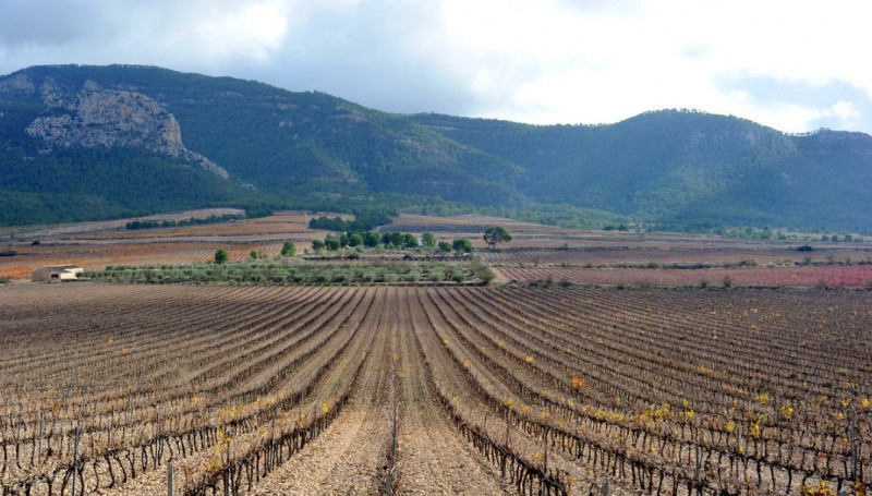
Dramatic scenery above the vineyards and salt mines of south-eastern Jumilla
The regional park of Sierra del Carche occupies an area of 5,942 hectares, and includes the Cabezo de la Rosa – a saline diapir of great geological interest – and deep ravines such as those of San Cristóbal, La Guarafía and La Yedra, which in times of heavy rainfall feature waterfalls at El Saltador.
Here the Mediterranean flora includes Aleppo and maritime pines, holm oaks, juniper, strawberry trees, esparto grass and lavender, while the fauna is characterized by birds of prey such as the golden and booted eagles, eagle owls and peregrine falcons. These predators feed on reptiles, rodents and smaller birds, while in among the undergrowth and crop fields there are also red-legged partridges, Iberian grey shrikes and warblers. Also present are foxes, badgers and boar, the commonest carnivorous mammals in the local ecosystem.
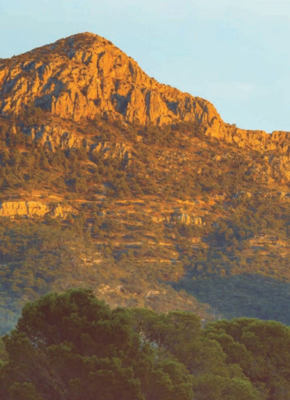 The highest peak in the range, the Madama del Carche, reaches an altitude of 1,372 metres above sea level, and the landscape features also include the picturesque ravine known as Barranco de la Guarafia, the pine forest of the Umbría del Revolcador and the rocky escarpment of Peña del Castelar, offering splendid views. More locations to head for include the Barranco de San Cristobal (rocky escarpments and dense vegetation), the spectacular rock deposits of La Pedriza, the south-facing Solana de La Alberquilla, the fossil site of “La Curiosa” and the natural spring of La Sanguijuela, which has been used for crop cultivation and human consumption for centuries and, possibly, millennia.
The area is also of interest to those who enjoy exploring the underground landscape, with a series of 13 small to medium-sized caves and potholes.
History
There is evidence of Man having inhabited the mountains from around 5,000 years ago, with Late Stone Age materials having been found at the cave of La Peña del Castelar, and in the Bronze Age (1900-600 BC) there were at least three fortified settlements. These are known as Romania (near Las Pansas), Castillicos del Salero and Solana de los Granaicos (both close to the salt mines and pools of La Rosa at the western end of the Sierra).
Iberian sites dating from between 600 and 200 BC have been identified at Castillicos del Salero and Karxa del Salero, and the remains of Roman villas and aqueducts can be seen at La Graya (Hoya del Carche), Karxa de los Estanquicos and Karxa del Balsón (on the southern slopes of the Cabezo de La Rosa).
Ceramics and large food storage jars dating from the Moorish occupation of southern Spain have also been found at Cabezo de la Rosa, while other historic buildings in the Sierra include a 17th century cylindrical snow well, the 18th century churches of Santa Rosa and the Sagrado Corazón and the 19th century “cuco de La Alberquilla”: a cuco was a rudimentary dry stone structure built by the farmers of Jumilla in the past to provide temporary shelter from the storms and other adverse weather conditions which can affect the area while caring for their vines.
Indeed, this is one of the most important grape-growing areas of the large municipality of Jumilla, with vineyards dominating the lower slopes of El Carche. Over the course of the centuries, though, the natural resources have also been exploited for timber, salt mining (still active in La Rosa), the cultivation of almonds and cereal crops, cattle farming, aromatic plants and beekeeping.
Access to Sierra del Carche is along the MU-15A road which heads east out of Jumilla or the RM-427 which skirts the southern side of the mountains and leads to Pinoso, or from the village of Raspay.
The 17-kilometre PR-2 walking route leads from Torre del Rico to the peak of the Sierra del Carche, and is described as being an easy walk, while the PR-3 starts at Casas de La Rosa and leads to the Barranco del Saltaor. This moderately difficult route covers a distance of 10 kilometres.
Facilities provided for walkers and other visitors include a basic shelter on El Revolcador with space for 50 people (no drinking water is provided and permission to use the building has to be requested from the Town Hall), a camping area close by, a wooden hut near the peak of El Carche and another shelter in Los Lomazos.
For more information about visiting Jumilla, including what's on, local news and all of the bodegas on the Jumilla wine route, visit the home page of Jumilla Today.
 WELCOME TO JUMILLA. WHAT'S ONCLICK HERE!
 JUMILLA WHAT TO SEE.CLICK HERE!
 JUMILLA WINE ROUTE.CLICK HERE!
 JUMILLA GASTRONOMY.CLICK HERE!
 JUMILLA PLACES TO VISIT.CLICK HERE!



 The highest peak in the range, the Madama del Carche, reaches an altitude of 1,372 metres above sea level, and the landscape features also include the picturesque ravine known as Barranco de la Guarafia, the pine forest of the Umbría del Revolcador and the rocky escarpment of Peña del Castelar, offering splendid views. More locations to head for include the Barranco de San Cristobal (rocky escarpments and dense vegetation), the spectacular rock deposits of La Pedriza, the south-facing Solana de La Alberquilla, the fossil site of “La Curiosa” and the natural spring of La Sanguijuela, which has been used for crop cultivation and human consumption for centuries and, possibly, millennia.
